

11 excursions to fall in love with Norway
Okay, to fall in love with Norway, you only need to drive through it and enjoy its magnificent views. But if you have the energy to sling on your backpack, perhaps a tent, and hike its trails, you will have priceless rewards.
The variety of hiking trails is endless: you can traverse windy heathlands and look down on a lake, or rocky slopes polished by ice to towering fjord shores. You will make your way through thorny shrubs and blueberry plants to a high point overlooking the endless sea dotted with islands. You will sleep in a tent on the edge of a ravine and wake up by bathing in the icy waters that wash a white sandy beach. You will admire from high ground the coastal towns and turquoise waters lapping the coast.

The excursions in Norway were some of the most rewarding we have ever taken, so you have only to choose. Keep in mind that we are very well trained and experienced hikers, so the timings described for the hikes are for people not only in excellent physical shape but used to this type of activity, as well as with appropriate hiking equipment.
For some of these hikes, moreover, weather conditions are really crucial in order not to take risks. For this very reason, it is not possible to access them all year round, and in some seasons there is possibly an obligation to do them with a guide. So inform yourself properly before you go.
1. PREIKESTOLEN
Type: wetlands, rock
Level: medium, beginner hikers
Duration: 3h round trip
Distance: 8km
Elevation gain: approx. 500m
Equipment: hiking boots, hiking poles

The hike to the famous rock outcrop is well known and well beaten, as with relatively little effort you can reach an icon of Norway. After a stretch of forest, some passages over wetlands, and the last stretch over granite massifs, you reach this prism jutting out over the fjord that offers spectacular views 600m above sea level.
Between a shiver down your spine and a sigh of wonder, if you climb this natural podium you will be truly impressed.


To appreciate the beauty of this place, we suggest you go up early in the morning to avoid the hours when there are so many people reaching it that you cannot find a space for a solo photo. In addition, although the trail is not particularly rough, it is not a walk suitable for everyone, and you will often find yourself queuing up behind people who are struggling to proceed. Not to mention the pleasure of enjoying this place in the silence and peace of the early morning.
Camping is not possible here, and you cannot even stay overnight in the base camp parking lot. You can, however, stay in the Preikestolen Fjellstue, a Lodge right at the beginning of the hiking trail, where, by the way, you can also eat very well.
2. TROLLTUNGA (overnight trekking with tent)
Type: wetlands, rock
Level: very difficult, experienced hikers
Duration: 10h round trip
Distance: 27km
Elevation gain: approx. 800m
Equipment: hiking boots, poles, crampons depending on the season

This was definitely the most challenging hike we did. To complete it, we decided to sleep along the trail in tents to enjoy this lonely land.
To get to the beginning of the trek leading to Trolltunga, there are 3 parking lots, with a shuttle connecting them and a toll road. We parked at P2 Skjeggedal, from which there is still a winding and very steep stretch of road to get to P3, which we hiked. From the top, the trail winds through rushing streams, swampy areas, rocky expanses, and to say it is challenging, especially with a backpack loaded with camping gear, is an understatement. In addition, temperatures at 1200m are really low in the evening. After struggling through snow-covered moors and small lakes, we arrived at a meadow overlooking the lake on which we pitched our tent and stayed overnight.


In the morning, we had to wait until it was clearing to begin our last part of the walk, until we reached the coveted viewpoint, a tongue of rock jutting perilously toward a lake that, if you are lucky, sparkles in the sunlight.
The entire walk offers fabulous views and a pristine landscape. Thanks to the difficulty of the trail, this is definitely not a crowded place.
3. REINEBRINGEN (Lofoten Islands)
Type: rock, dirt
Level: medium, beginner hikers
Duration: 1.5-2h round trip
Distance: 2km
Elevation gain: approx. 440m
Equipment: hiking boots, hiking poles

This short but intense trek leads to a viewpoint overlooking the small village of Reine in the beautiful Lofoten archipelago.
The trail is very steep, with somewhat rough sections where you will need free hands to hold on, and it leads to a narrow viewpoint on the ridge of the mountain that offers 360-degree views of the islands, the roads that seem to float on the sea, and the red rorbuers that stand out in the green and blue. There really isn't room for everyone when you get to the top, and with the wind you almost struggle to stand, but the view is lovely. This section is very crowded and a bit dangerous if you find yourself crossing paths with people at points where there is only room for one. So walk it with caution, perhaps at off-peak times.
4. RYTEN E KVALVIKA (Lofoten Islands - overnight with tent)
Type: wetlands
Level: medium, beginner hikers
Duration: 1.5h to the top, 45' downhill to the beach, 1h return from the beach
Distance: 4km
Elevation gain: approx. 540m
Equipment: hiking boots, poles, swimsuit :)

Starting from the small village of Fredvang, we begin by crossing pastures and marshy land covered with tall grass, and begin to climb toward ridges that offer beautiful views of bays and sea on either side. The ascent is relatively gentle and the terrain is not rough. When you reach the top of Ryten, you can pitch a tent by finding a place not exposed to the wind, and enjoy a magnificent sunset overlooking the sea, as we did.
The next morning, having withdrawn our tents, we walked back down, but instead of heading back toward the village, we took the path that rejoins the one coming straight from the houses, heading to Kvalvika beach.

This section of the trail, although more popular, is decidedly more impassable, and one often loses track of it among the scree sloping unevenly down to the sea.
The beach is wonderful from the viewpoint at the top, from which emerges a crescent of white sand lapped by emerald waters, but also when, after the long trek, you sink your feet into the Caribbean-looking but polar-temperature sand. Take a nice "refreshing" swim, too, with the waters a few degrees above zero. At least you will be able to say that you have bathed north of the Arctic Circle!


5. MANNEN HAUKLAND (Lofoten Islands)
Type: dirt road, rock
Level: easy, suitable for all
Duration: 1h round trip
Distance: 1.75km
Height difference: approx. 400m
Equipment: hiking boots, poles, swimsuit :)

The ascent to the top of Mannen is quite easy as a hike, and for that reason also very crowded. You park at the beginning of the trail, just after Haukland Beach, whose magnificent views you enjoy once you get to the top.
As with other viewpoints, there is not much room to stand on once you arrive, and you will have to take turns with other hikers to take a few photos of the magnificent view of the bays and sea from the top.
Again, don't forget to put your swimsuit in your backpack for a refreshing dip once you get back to the valley.

6. RAMBERGVIKA (VESTVÅGØY) (Lofoten Islands, night hike)
Type: dirt road, taiga
Level: easy, suitable for everyone
Duration: 1h round trip
Distance: 1.75km
Height difference: approx. 130m
Equipment: hiking boots or sturdy shoes

This easy hike leads through intricate expanses of dense shrubs and arctic berries on a gentle ridge with magnificent views of bays, mountains, islets over the sea. There is a magnificent sunset, and so we decided to undertake it late in the evening so that we would be around midnight at the top enjoying the last rays of sun still on the horizon line.
This trail is difficult to locate even on maps; it is not a marked hike on the apps, so you will probably be alone surrounded by silence. That is, if you can find your way!
To reach this viewpoint, you will have to travel along E10 on the section from Lake Torvdalsvatnet to Lake Urvatnet, before the road bends toward Knutstad.

7. DJEVELPORTEN E FLØYA TRAILHEAD (Lofoten Islands)
Type: dirt, rock
Level: medium, beginner hikers
Duration: 3h round trip
Distance: 3km
Elevation gain: approx. 590m
Equipment: hiking boots, poles

You start in Svolvær and arrive at a viewpoint overlooking the town itself. The trail is not difficult except for a few steeper sections, but there are several exposed areas and it is not suitable for everyone. It also requires about 1.5-2h of walking just to reach the viewpoint in Fløya. The trail often gets lost in rock slides and there are a few detours for other hikes. Best to have a hiking app or map handy.
Even on this hike, from the top you will have the opportunity to admire brightly colored bays and the succession of peaks and islands of the archipelago.

8. SEGLA TRAIL E HESTEN
Type: dirt, rock
Level: medium, beginner hikers
Duration: 2h round trip
Distance: 4km
Elevation gain: approx. 400m
Equipment: hiking boots, poles


The hike starts from the village of Fjordgard, and is fairly easy, unraveling through expanses of blueberry plants, small shrubs, and then taiga and rocky terrain to the summit of Hesten. From here, a windy peak overlooking the bay, one can continue on the trail to the exposed ridge on a vertiginous cliff face that plunges over a magnificent fjord. On this trail you can have a beautiful view (if you are luckier than us, perhaps cloudless) of Mt. Segla. This too can be climbed (experienced rock climbers), but the best panoramic views are obtained from the trail coming from Hesten.
9. HUSFJELLET
Type: unpaved
Level: easy, suitable for everyone
Duration: 3h round trip
Distance: 3.8km
Height difference: approx. 600m
Equipment: hiking boots, poles


This hike is truly scenic, and a relatively easy trail uncovered on the ridge of a slope leads to endless views of the sea, the mountain ridges of the Senja peninsula, and the small islands with white sand that dot the sea with their emerald green waters. The trail is relatively uncrowded, and, when sunny, is a pleasant and relaxing trek.

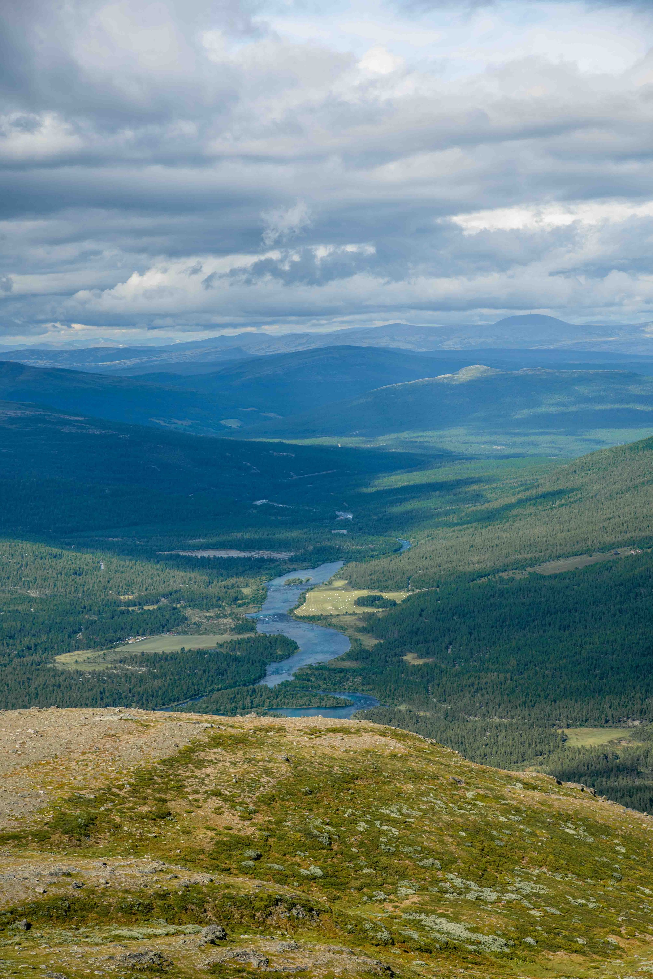
10. STUTTGONGKAMPEN
Type: forest, taiga
Level: easy, suitable for everyone
Duration: 4h round trip
Distance: 11km
Elevation gain: approx. 650m
Equipment: hiking boots

This trek is very long but not hard. The beauty of this trail within the Stuttgonglie Nature Reserve is the variety of landscapes. One crosses streams, skirts rushing rivers, travels through birch forests and grasslands, with endless views not of fjords or lakes, but this time of slopes, hills and mountains also covered with forests. A distinctly different panorama from those of other hikes. The trail is very little traveled.


11. GHIACCIAIO NIGARDSBREEN
Type: rock
Level: easy, suitable for all
Duration: 1.5h round trip
Distance: 5km
Height difference: approx. 180m
Equipment: hiking boots, poles

Short route and unique views. This short trek is not trivial, given the slippery ground at the edge of the river of water coming down from the glacier, but it is suitable for everyone if well equipped with the right shoes. You start at the parking lot of the same name and follow the stream until you get right to the foot of the glacier, which with its blue crevasses provides a truly magical view. One of the few glaciers that continue to grow in Europe, so enjoy this genuine rarity with respect.


