
Alta Via 4 on the Dolomites: routes and tips
When it comes to trekking, mountain landscapes, a few days away from civilization surrounded by nature, I could not recommend a better place than the Dolomites. Maybe just because my faithful travelling companion, Nic, spent all his childhood among these rocks, among these meadows, among the snowy peaks and the remote valleys of Trentino. He could tell you where he is by looking at just one peak, and organize a day or month-long excursion; and since we travel together, he never misses an opportunity to show me every possible corner of these mountains, in winter or summer, with boots or skis on our feet, a map in the pocket and a sleeping bag in the backpack.
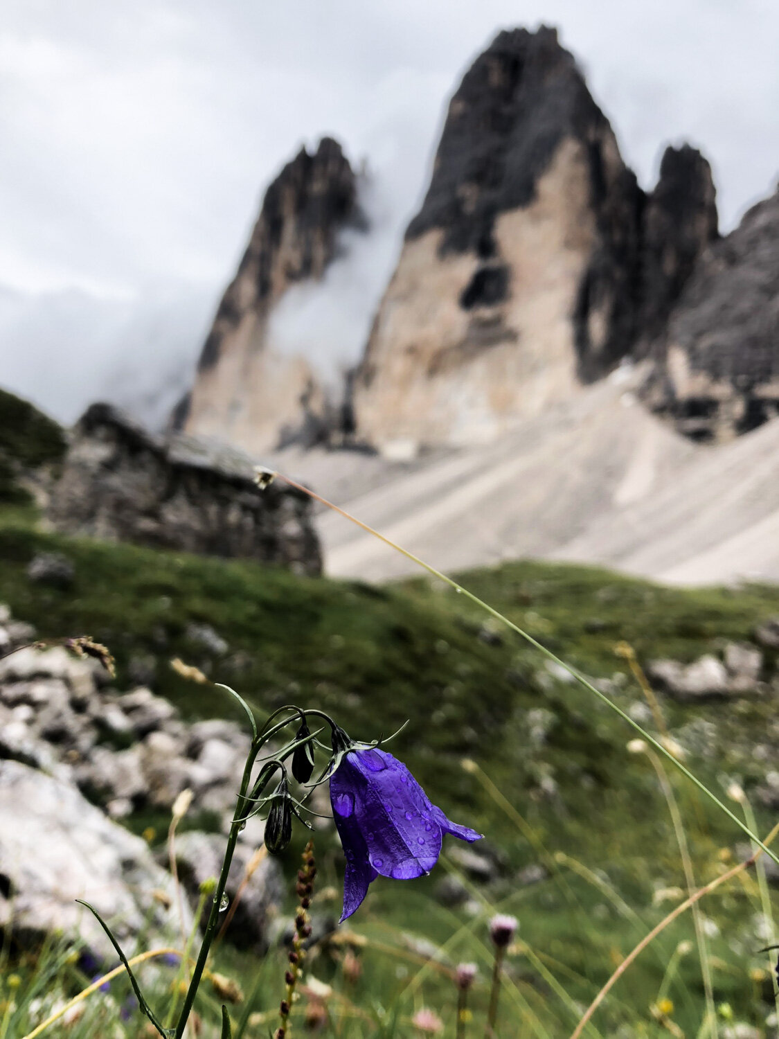
The beauty of the Dolomites is that they offer cues for the quiet lovers of small mountain villages, for hunters of inhospitable and dramatic mountains, for history lovers, for tourists and less experienced hikers who are just looking for a walk of a few hours (or even more comfortably a cable car ride) to immortalize the famous Three Peaks, or for avid trekkers, who love to walk for hours and days, without ever seeing their destination, which is always one peak further away, between valleys covered by meadows, and steep moraines.
If you're wondering which category we belong to, you only need to read the report of our trek that lasted four days on the Alta Via 4, among incredible landscapes, endless climbs, some equipped sections a bit too exposed for my taste, and spartan refuges full of atmosphere and good food.
DAY 1
DEPARTURE: Moso (Sesto), 1350 m - free parking in Bagni di Moso
ARRIVAL: Locatelli Refuge, 2405 m
DURATION: 3 h
UP/DOWN ALTITUDE DIFFERENCE: + 1300 m, - 200 m
DIFFICULTY: T3
We start the trek at 11:00. This route can be undertaken starting from San Candido, Dobbiaco, or starting from Moso, where we have started the ascent so as to cover the picturesque Val Fiscalina. The initial stretch belongs to the Alta Via 5. The first part of the trek is gentle and pleasant, through dense pine forests, covered by meadows and dotted with wooden farmsteads.
Following path 102 we arrive, in about 3 hours, at the Locatelli refuge: the route crosses the Val Sassovecchio, among rocky areas crossed by streams, and more gentle green valleys. The stretch we walk along is not tiring and we start to enjoy a beautiful view of the most rugged peaks. We arrive at the refuge at 14:30, armed with speck-sandwiches prepared on the road in the morning at a local butcher.


The afternoon program was to arrive at the Comici refuge, where we planned to spend the night. We embarked on the trek in August, when all the huts tend to be booked, and the Locatelli refuge, which occupies the most picturesque position in the surroundings, had been full for months. However, we dared to ask in the refuge if any place had been vacated, and we managed to gain two places in a small secondary dormitory, very spartan indeed, but with a privileged view of the famous Three Peaks of Lavaredo.
We move away from the crowds that orbit around the refuge in the middle of the day, and continue, without our backpacks, part of the route planned for the afternoon. We start at 3:45 p.m. the tour of Mount Paterno on path 101, up to the Pian di Cengia refuge: this can be reached through a path that climbs a rocky coast where we meet extremely suggestive war tunnels. These mountains, in fact, were the scene of the border clashes of the First World War, and on the paths that cross them there are often tangles of barbed wire from the trenches, remains of metal objects and cans, and tunnels dug into the rock studded with military graffiti.


After a snack-stop at the refuge, we continue towards the Fiscalino Pass, rejoin trail 104 and among green meadows and some marmots, we return to the refuge through the Forcella Lavaredo, in front of the Tre Cime. The hut offers us a convivial and spartan dinner at 7:00 p.m.: butter-cancì (local buckwheat ravioli) filled with ricotta and spinach and grilled cheese with polenta, which make the long journey we have undertaken seem much sweeter. Sleeping in this refuge offers the possibility to stay after sunset, when the crowds of tourists disperse, and the silence and twilight envelop the Three Peaks on the background.


DAY 2
DEPARTURE: Locatelli Refuge, 2405 m
ARRIVAL: Refuge Città di Carpi, 2130 m
DURATION: 8.45 h
UP/DOWN ALTITUDE DIFFERENCE: + 1000 m, - 1300 m
DIFFICULTY: T4 (with difficult equipped passages)
We have breakfast and pick up our backpacks and in the pouring rain we begin the long journey of the day, through path 105 which runs along the Three Peaks and offers an exceptional panorama. We take a break of about half an hour at Rifugio Auronzo at 10:30 a.m., stopped by the pouring rain, trying to dry our already soaked clothes, and then we start again on path 117 (Sentiero Attrezzato Bonacossa) among breathtaking views on both sides of the ridge we walk along, some military posts and some particularly exposed rig passages that we suggest you to cross with the via ferrata equipment, unlike we did.
Once at Forcella Rinbianco, we walk uphill to the Fratelli Fonda Savio Refuge, 2367 m, where we stop for lunch. We retrace back the stretch leading to the refuge and continue along the Durissini path. We go up and down repeatedly, between valleys and forks, until we reach the last valley, at the end of which there is the Città di Carpi hut where we stay for the night.

The last stretch is pleasant and not very difficult, even if we had to run through it under a violent storm, between lightning and thunder, and we arrived soaked and frozen at the destination, where after a very fast and very expensive hot shower, shared in two, to regain sensitivity, we warmed up with a substantial plate of potatoes and bacon.
DAY 3
DEPARTURE: Refuge City of Carpi, 2130 m
ARRIVAL: Vandelli Refuge, 1928 m
DURATION: 8 h
UP/DOWN ALTITUDE DIFFERENCE: + 400 m, - 600 m
DIFFICULTY: T3 (with equipped passages)
The sunrise at the refuge offers us a beautiful view of the Cadini di Misurina, which emerge from the green woods.
We continue the route on the Alta Via 4 through path 120 for about 1 hour, reaching the Col De Varda refuge, quite busy as it is equipped with a cable car that connects to Lake Misurina. We walk along this stretch, up to the lake, with a beautiful view of the Cristallo in front of us. This part of the hike is very easy and also frequented by Sunday hikers and families.

Once arrived at the lake, we take the path that runs along the state road that leads to Auronzo, up to the Bivio Dogana Vecchia. We travel almost all the way along the main road, except for a short stretch in the woods that reaches Passo Tre Croci (1791 m). After lunch we resume the itinerary on path 215 towards the Vandelli refuge, where we spend the night.
This part of the route is unfortunately mainstream, as it leads to the famous Sorapiss Lake, which is very popular with children, improvised hikers and foreign tourists. The route ends in about two hours, but in the afternoon it is very annoying to make it to the lake, because you will meet a multitude of people who return from the day trip and crowd the narrow stretches, sometimes equipped, on the steep side of the mountain.
However, we arrive in time to enjoy the lake now deserted, at dusk, a few meters from the refuge: a flat diamond of an unreal blue colour, set between rocky and rugged peaks, motionless and imperturbable.


DAY 4
DEPARTURE: Vandelli Refuge, 1928 m
ARRIVAL: Cortina
DURATION: 8 h
UP/DOWN ALTITUDE DIFFERENCE: + 700 m, - 500 m
DIFFICULTY: T4 (with very exposed equipped passages)

As the night before, before breakfast we go to the desert lake, where we enjoy the wonderful sunrise on this unreal mirror of water that still reflects the mountains. The unnatural and opalescent colour of the lake is generated by the very fine limestone dust transported in these waters by the erosion of the surrounding rocks.


At 8:00 a.m. we resume the last (very long) part of the route, along path 215, moving away from Alta Via 4 and taking path 3. Walking along the lake, and going up the slope that watches over it, we arrive at the Sella di Punta Negra (2636 m). The path, after a first fork, continues on a deserted and inhospitable landscape, in the shade of the high peaks that border a valley, strewn with debris. To reach the fork we walk along a very unfriendly exposed and equipped section.


When it seems to have finally reached the destination, a steep descent towards the Cortina basin awaits us, on a gravelly ridge that puts even the most trained knees to the test.
The long route in the morning is exhausting, also considering the previous days' tiredness, and with fatigue (at least for me) we reach Rifugio Tondi, where we stop for lunch and decide to end the day reaching Cortina with the cable car that leaves from Rifugio Faloria a little further down. (one way ticket 8 € each) We return to the parking lot from Cortina.
This incredible route took us through spectacular views, but it was physically very stressful, at least for a hiker who is still not as used as I am. If, however, you feel trained, and want to return home with exceptional images imprinted in your memory, do not miss the opportunity to retrace our steps and complete this beautiful adventure, perhaps planning some softer alternatives to the more inaccessible passages.

This content is NOT SPONSORED, but based on my genuine personal experience. Spontaneous opinions, positive and negative, shareable or not, that I hope will help to live better travel experiences. My advice is a guide to lead you through world explorations, but the real journey, you build it!

